
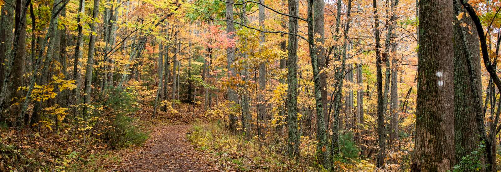
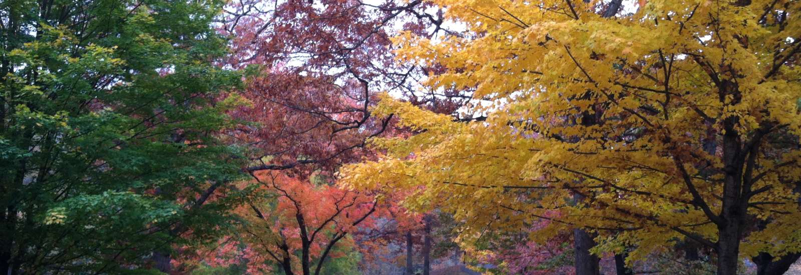
Easy Hiking Trails Near Asheville, N.C.
Trail Filterscollapse
Difficulty
Length
Trail Usage
-
Features
-
Features
Type
Travel Time*
*Travel Time is represented by the distance from downtown Asheville
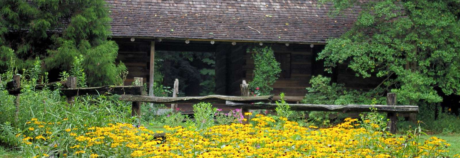
Asheville Botanical Gardens Trails
- Distance from Asheville: 1.5 miles
- Length: 0.5-mile loop
- Difficulty: Easy
Just north of downtown, the 10-acre Asheville Botanical Gardens at the University of North Carolina at Asheville is an urban oasis with a shady half-mile loop trail that highlights 600 species of plants native to the Southern Appalachians. Reflecting Asheville’s character, this botanical garden isn’t too formal. You’ll often find students here writing in journals, sketching or doing yoga and kids playing the creek or people picnicking. For a quick introduction to the mountain landscape, it can’t be beat. More Info

Biltmore Estate Trails
- Distance from Asheville: 2 miles
- Length: 1.7 to 6 miles round-trip
- Difficulty: Easy to Moderate
Biltmore’s trails are accessible to those who have either an annual pass or ticket. Once you’re on the estate, you can choose to start your hike from the house, the Lagoon, the Bass Pond, the Inn or the area near Antler Hill Village. Possibly the best option is to pick up a trail map from the Outdoor Center at Antler Hill Village. More Info

Black Balsam Hike on Art Loeb Trail
- Distance from Asheville: About 36 miles (1 hour)
- Length: 2 miles round trip to Black Balsam (with options to add on to create a longer hike or loop).
- Difficulty: Easy to Moderate
Surrounded by wilderness, this tree-free ‘bald’ is an easy-to-moderate, family-friendly hike, ideal for picnicking or blueberry picking. More Info
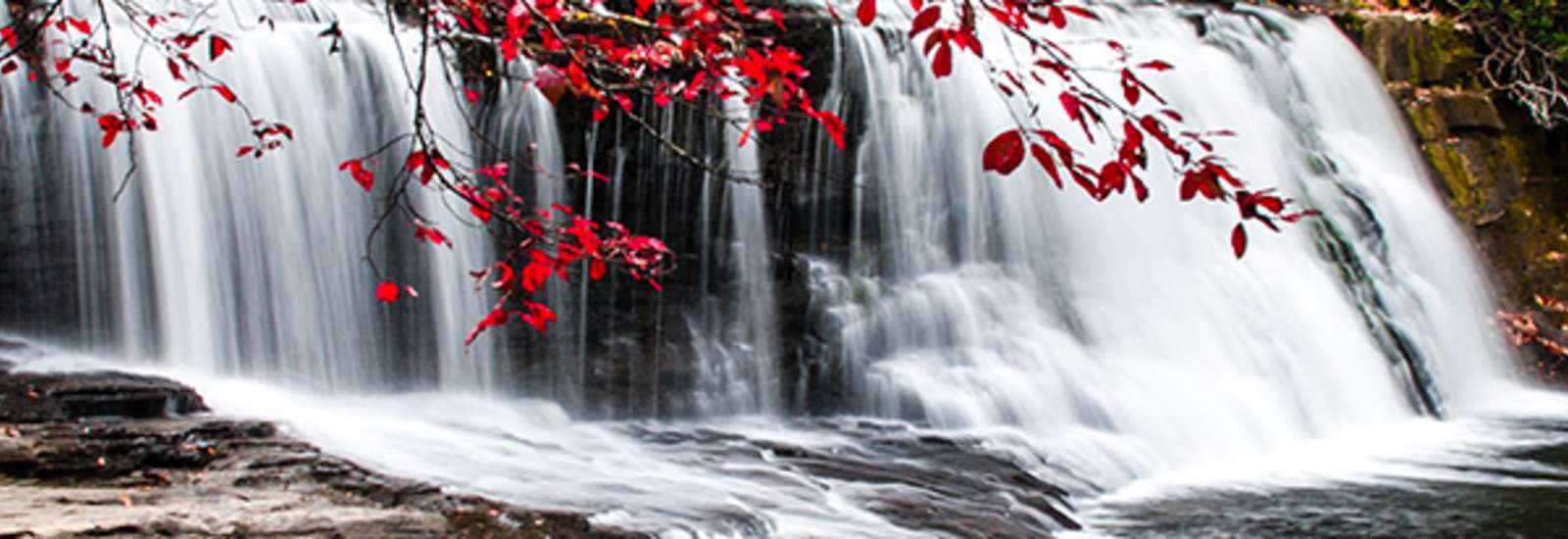
Bridal Veil Falls Hike
- Distance from Asheville: About 38 miles; 50-60 minute drive
- Length: 1.88 miles each way
- Difficulty: Easy to Moderate
Fans of The Hunger Games and Last of the Mohicans were introduced to Bridal Veil Falls in Dupont State Forest on the silver screen. Hikers can easily take in the view, too, with this easy, scenic stroll through the woods. With plenty of exposed rock around the falls, this is a great picnic spot. More Info
Catawba Falls Trail - REOPENS 5-31-24
- Distance from Asheville: About 25 miles; 30 minutes
- Length: 1.5 miles each way; 3 miles round-trip
- Difficulty: Easy
Catawba Falls is relatively close to downtown Asheville (just 25 miles away) and offers stunning beauty thanks to a series of cascades that, together, are 100 feet tall. The U.S. Forest Service recently has made the easy-to-moderate trail even more enjoyable by adding two new footbridges so that you no longer have to rock hop across the river to enjoy the falls. The hike is just three miles round trip. More Info
Glassy Mountain Trail at the Carl Sandburg Home
- Distance from Asheville: Around 31 miles; 40 minutes
- Length: 1.3 miles from the house to the top of Big Glassy Mountain
- Difficulty: Easy
Carl Sandburg, “the People’s Poet” bought his historic home Connemara in 1945. After he died, his wife donated the property to the National Park Service and now this 267-acre National Historic Site preserves his legacy. This great day trip from Asheville combines history, nature and (especially interesting for kids) lots of goats. More Info
Hard Times Loop Trail
- Distance from Asheville: 15 minutes
- Length: 6 miles
- Difficulty: Easy
This gentle trail takes hikers through Bent Creek Experimental Forest and the North Carolina Arboretum, with great views of mountain ridges and Lake Powhatan, as well as a glimpse of the magnificent Biltmore House. More Info
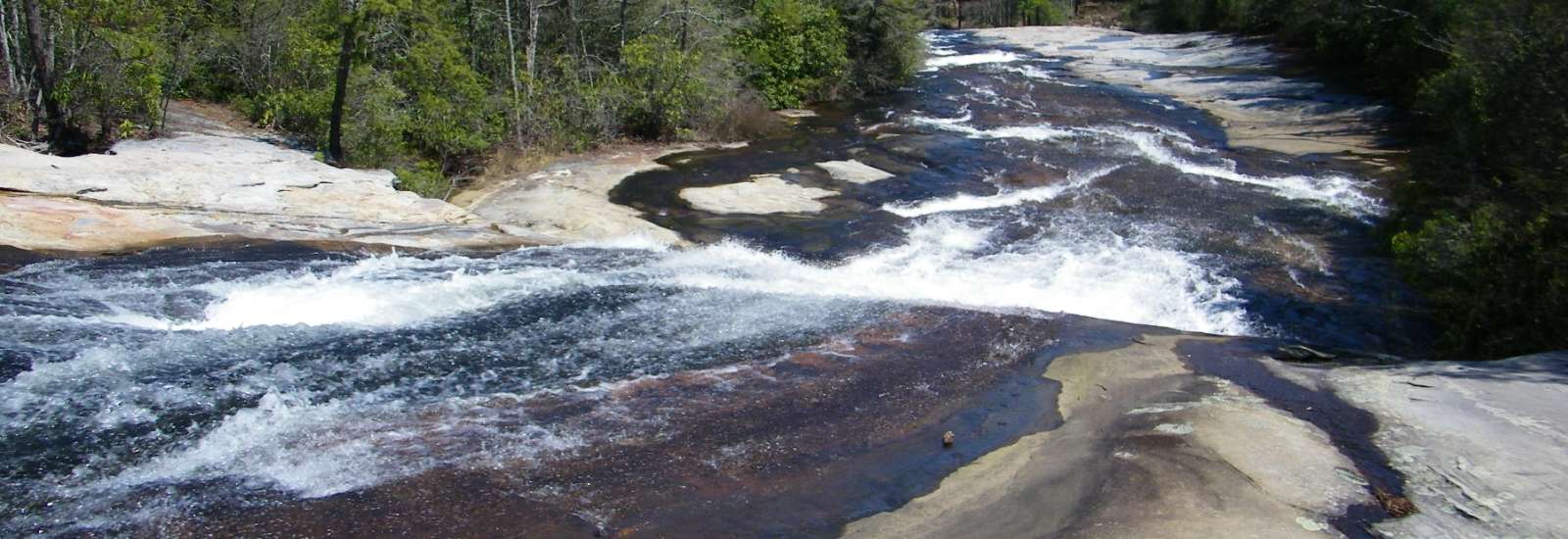
Hooker Falls, Triple Falls, and High Falls Hike
- Distance from Asheville: About 38 miles; 50-60 minute drive
- Length: Hooker Falls, .4 miles each way Triple Falls, .5 mile from Hooker Falls Parking Lot High Falls Trail, .5 mile from Triple Falls 2.2 miles total for all three falls
- Difficulty: Easy to Moderate
Dupont State Forest is the best place to discover why Brevard and Transylvania County is called “The Land of the Waterfalls.” Get a sampler of some of the area’s wonderful waterfalls with a (mostly) easy hike to Hooker Falls, Triple Falls and High Falls. Accessible enough for kids, the trails that connect the falls are scenic and include picnic spots. Fans of The Hunger Games and The Last of the Mohicanswill recognize some of the scenery. More Info
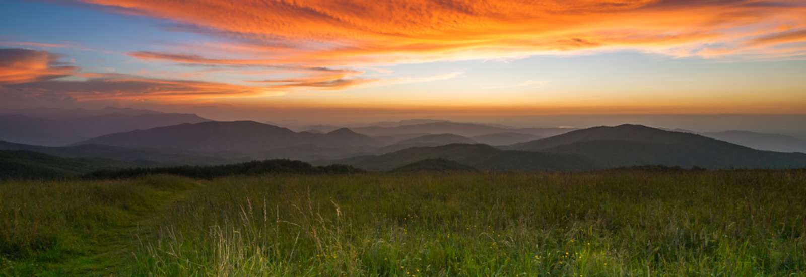
Max Patch Trail
- Distance from Asheville: About 40 miles; 70-75 minute drive
- Length: 1.5 miles
- Difficulty: Easy to Moderate
Max Patch is a “bald,” the Southern Appalachian name for a hilltop without a single tree. While this mountain isn’t naturally bald (it was cleared for grazing in the nineteenth century), it’s certainly naturally beautiful. Some call it “the crown jewel of the Appalachian Trail,” the famous footpath which crosses it at the top. Bring a picnic, a Frisbee or a kite and plan on practicing yoga in the idyllic scenery here near Hot Springs. More Info
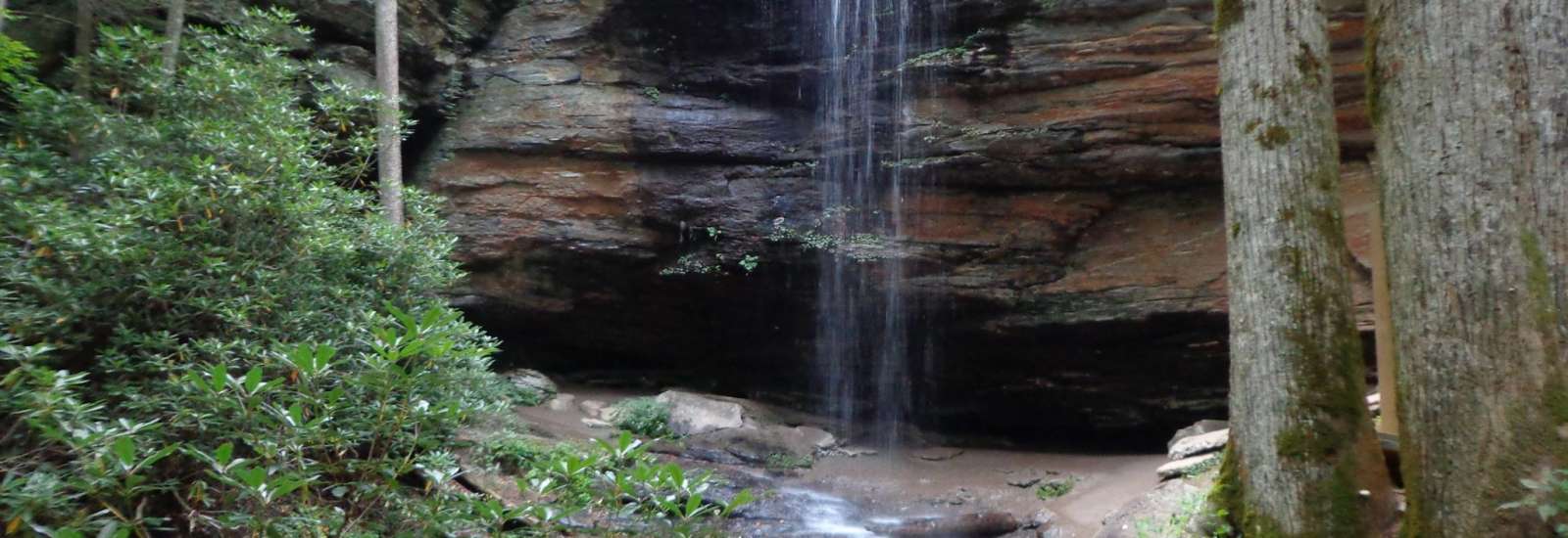
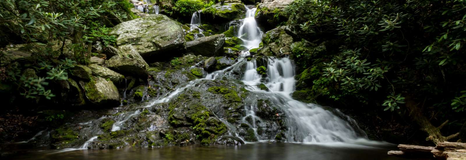
Moore Cove Falls Trail
- Distance from Asheville: About 38 miles; 45 minutes
- Length: .7 miles each way in and out, 1.4 miles total
- Difficulty: Easy
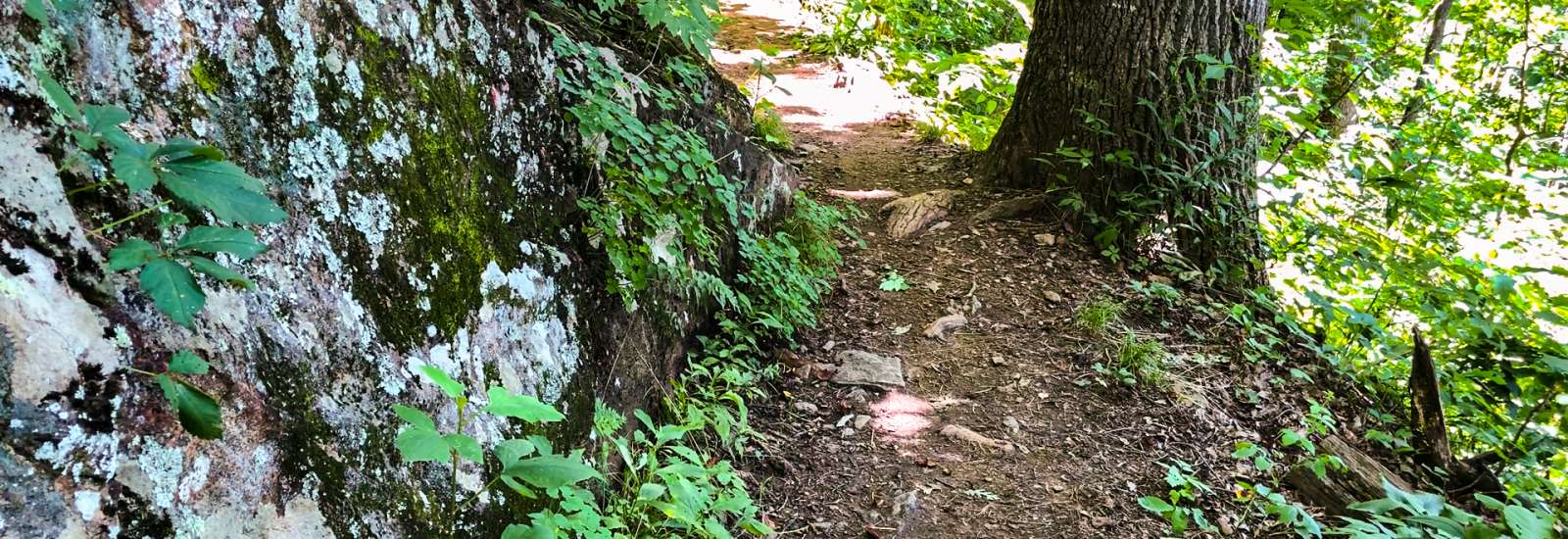
The trail starts with a lovely wooden bridge over the creek, followed by a set of stairs down. The hardest part of this trail is in the first 1/10th of a mile. After that, it’s wide and mostly downhill into a cool, shady forest. In the spring, there are a variety of shade-loving flowers here such as jack-in-the-pulpit and trillium. There are ferns all year round. Several more wooden bridges on the way traverse over the babbling creek. There are only a few relatively steep spots with built-in steps along the way. More Info
Mountains-To-Sea-Trail at Craven Gap
- Distance from Asheville: About 7 miles, 15 minutes
- Length: 4.8 miles round trip
- Difficulty: Moderate
With thousands of acres of wilderness close to Asheville, where do you start to explore? For an introduction to the splendor of mountain scenery, try Craven Gap off the Blue Ridge Parkway, just 15 minutes from downtown. It’s a hike that families can enjoy. It's also the only place a president has set foot on the Parkway: President and Mrs. Obama hiked here in 2010. More Info
Mount Pisgah Trail
- Distance from Asheville: About 35 minutes
- Length: 2.6 miles round-trip
- Difficulty: Moderate
Mount Pisgah can be seen from many places throughout the Asheville area. In fact, many of Biltmore's windows perfectly frame this iconic peak. Once you reach the summit, you'll have a great view of another of the area's most iconic peaks: Cold Mountain. More Info
Laurel River Trail
- Distance from Asheville: About 36 miles; 30 minutes
- Length: 3.6 miles to the end, but can be hiked to any length
- Difficulty: Easy
There’s something about the Laurel River Trail that feels hidden and undiscovered, even if you’re sharing this former rail-bed trail with others. Take a picnic, bring your dog and wear your swimsuit if it’s summer. There are many places to sit out on the rocks and soak in the sun. This is a family-friendly hike that even small children can handle. Combine it with a visit to Hot Springs just 10 minutes farther away for a full-day outing. More Info
Pink Beds Hike
- Distance from Asheville: 31 miles, 50 minutes
- Length: 5.3 Miles
- Difficulty: Easy
Nature lovers flock to the Pink Beds Loop Trail in Pisgah National Forest. The sounds of the rushing creeks and bird song add a peaceful, unhurried feeling to the atmosphere. Evidence of wildlife—such as the beaver dams seen on the ponds—is all around on this winding woodland trail. More Info
Riverside Cemetery Hike
- Distance from Asheville: 1 mile; 5 minutes
- Length: 3.5 miles of paved roads inside the gates
- Difficulty: Easy
Designed in 1885 in the park-like Victorian style, Riverside Cemetery is the final resting place of some of Asheville’s most prominent citizens, including Thomas Wolfe. Set on 87 shady acres, Riverside is a walk through Asheville’s past on smooth, paved trails, past over a dozen family mausoleums and impressive statuary. Stroll through this serene landscape for traces of Asheville’s early days. More Info
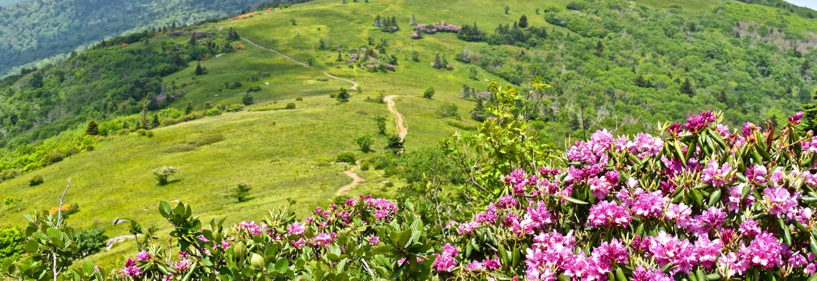
Roan Mountain Hike on the Appalachian Trail
- Distance from Asheville: 64 miles, 1 hour 30 minutes
- Length: About 5 miles roundtrip
- Difficulty: Easy to Moderate
Considered one of the most scenic areas on the entire Appalachian Trail, this section starting from Carver’s Gap (elevation 5,512) takes you across three spectacular unique grassy hilltops (known as "balds") with unimpeded views. More Info

© 2001-2024 ExploreAsheville.com
All Rights Reserved
All Rights Reserved

![]()