
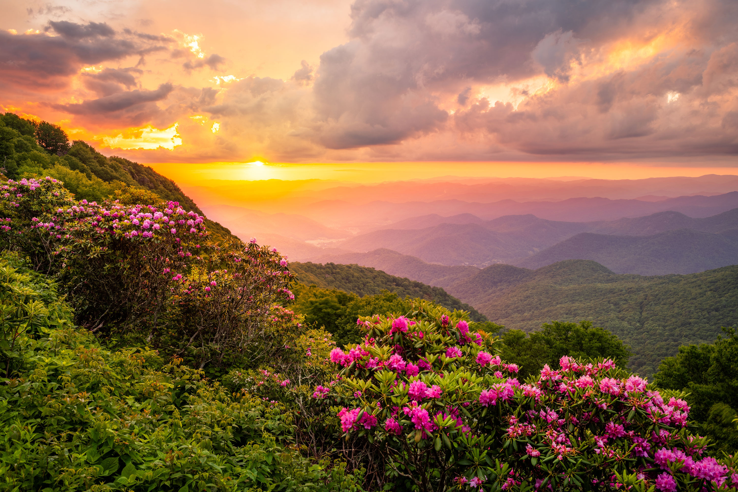
Blue Ridge Parkway
America’s Favorite Scenic Drive
Your Guide to Exploring Along the Blue Ridge Parkway
Cresting the Southern Appalachians' loftiest ridges, the Blue Ridge Parkway is your passage to outdoor wonder and awe-inspiring mountain panoramas.
All Asheville sections of the Parkway have reopened—restoring access to breathtaking hikes, picnic spots, and panoramic views. Before you go, be sure to check DriveNC.gov for current conditions and open routes. With a little planning, your Parkway adventure awaits.
Top Things to Do on the Blue Ridge Parkway
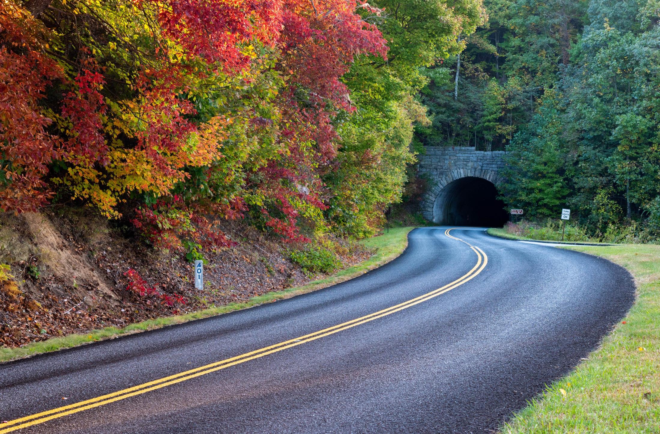
1. Scenic Drives: The best and easiest way to explore the 469-mile Blue Ridge Parkway is to go for a drive. Whether you drive for 10 miles or 50 — it's all up to you! And, it's easy to create an experience that fits with your itinerary of other things to do in Asheville.
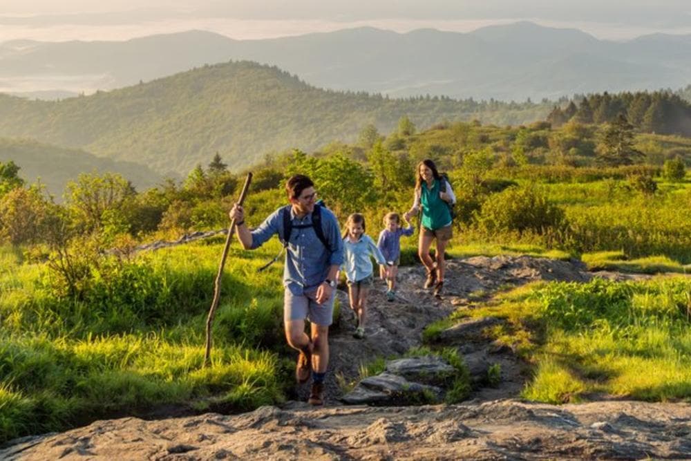
2. Hiking: The Blue Ridge Parkway is known for providing access to some of the best hiking trails in the nation. Whether you're looking for a short, easy hike or a more challenging trek, you'll find it on the Parkway. The forested trails lead to everything from 360-degree views to thundering waterfalls. See our guide to the best Blue Ridge Parkway hikes. Find your perfect Asheville hiking trail. Use our Asheville Hike Finder to easily filter by distance from downtown, trail length and difficulty level.
3. Picnicking: The dramatic views found on the Blue Ridge Parkway make for unforgettable picnic spots.
4. Biking: Bike the Blue Ridge Parkway for an outdoor adventure, and workout, like no other. See our guide to road biking adventures.
Scenic Drives
Hiking
Picnicking
Biking

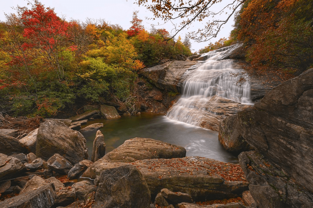
Lower Falls at Graveyard Fields by Eric Haggart
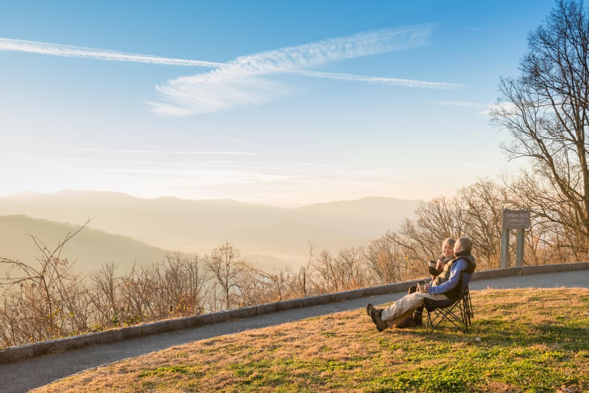
Tanbark Ridge Overlook, Blue Ridge Parkway by Emily Chaplin

Cycling on the Blue Ridge Parkway by Jared Kay
Top Places to Visit on the Blue Ridge Parkway
From natural wonders to an art gallery/shop, here are highlights of the Blue Ridge Parkway near Asheville. Note the distances from downtown Asheville in parenthesis.
PLEASE NOTE: As of 9/15/25, all Asheville sections of the Blue Ridge Parkway have reopened, from Mount Mitchell to Cherokee, NC. Visit the National Park Service website for current Blue Ridge Parkway road conditions, and refer to our open trail guide to find the perfect hike for you on the BRP.
North of Asheville
- Craggy Gardens — Milepost 364.4: Breathtaking views await at 5,640 feet above sea level. Craggy Gardens is home to a National Park Service visitor center, shop and restroom facilities. (24 miles, 35 minutes) *Reopened 9/15/25
- Mount Mitchell — Milepost 355.4: Explore the tallest mountain east of the Mississippi River. You can drive nearly all the way to the summit. From the parking area it's just a half-mile hike to reach the observation deck and enjoy the long-range mountain views. Mount Mitchell also has a museum, gift shop, restaurant (open during spring to fall) and restrooms. (35 miles, 1 hour) *Reopened 9/15/25
South of Asheville
- Folk Art Center — Milepost 382: This popular stop on the Parkway offers you the opportunity to view and purchase some of the region's best arts and crafts. The Folk Art Center hosts craft demonstrations and events throughout the year. (6 miles, 10 minutes)
- Blue Ridge Parkway Visitor Center — Milepost 382: Pick up maps, ask questions, see interactive exhibits and purchase souvenirs. (6 miles, 10 minutes)
- Mount Pisgah - Milepost 407.6: See Asheville's most iconic peak up close and personal. (26 miles, 40 minutes)
- Graveyard Fields — Milepost 417: This area, named for its unique landscape, offers relatively easy hiking trails to access to two waterfalls. (37 miles, 55 minutes)
- Black Balsam — Milepost 420.2: Black Balsam is a local and visitor favorite for hiking, especially on the popular Art Loeb Trail. (40 miles, 1 hour)
- Devil's Courthouse — Milepost 422.4: A large parking area provides a view of this unique rock formation. A strenuous hike takes you to the top for near 360-degree views. (42 miles, 1 hr. 5 minutes)
Plan Your Visit to the Blue Ridge Parkway
What to know about the Blue Ridge Parkway
- COST: It is FREE to drive the Blue Ridge Parkway. There is no admission fee.
- HOURS: The Blue Ridge Parkway is open 24 hours a day, 7 days a week year-round. However, the Parkway may close due to snow or ice. For real time road information, please see the interactive road closures map on the National Park Service web site.
- HOW TO NAVIGATE: There are stone markers at every mile along the Blue Ridge Parkway. These numbered mile markers are your guide for locating top attractions and overlooks.
- SPEED LIMIT: The Blue Ridge Parkway has a speed limit of 45 MPH, making for a leisurely drive. There are many paved overlooks where you can stop to rest, see the view or take photos.
- GAS: There are no gas stations on the Blue Ridge Parkway. But gas is available just off the Parkway at several major intersections with US or state highways. We recommend filling up your tank before driving on the Parkway.
- VEHICLES THAT CAN DRIVE THE PARKWAY: All non-commercial vehicles are welcome on the Blue Ridge Parkway.
How to get on the Blue Ridge Parkway in Asheville
In the Asheville area, there are four main entrances to the Blue Ridge Parkway. There are roadside signs before and at each of these entrances.
- US Highway 70 and Blue Ridge Parkway Milepost 382.6. Close by: Blue Ridge Parkway Folk Art Center, East Asheville, Interstate 40
- US Highway 74A and Blue Ridge Parkway Milepost: 384.7. Close by: Blue Ridge Park Visitor Center, the town of Fairview, East Asheville, Interstate 40
- US Highway 25 and Blue Ridge Parkway Milepost 388.8. Close by: Biltmore (three miles north), South Asheville
- NC Highway 191 and Blue Ridge Parkway Milepost 393.6: Close by: The North Carolina Arboretum, Asheville Outlets, Interstate 26
Blue Ridge Parkway Visitor Center
Asheville is home to the Blue Ridge Parkway Visitor Center. Pick up maps, ask questions, see interactive exhibits or purchase a souvenir. The Visitor Center is located at Blue Ridge Parkway Milepost 384.
When using a GPS, use the following address: 195 Hemphill Knob Rd., Asheville.


Request a Free Destination Guide
There’s no better way to start your trip planning than with Asheville’s Official Destination Guide.

Sign Up for Our Newsletter
Stay in the know with the best of Asheville delivered straight to your inbox.
Download the Explore Asheville App
Plan your time in Asheville from the comfort of your device.