Turkey Pen Gap Loop

The first ninety minutes are the toll you pay for the rest of the hike.
From the small gravel lot at the end of Turkeypen Road, the Turkey Pen Gap Loop wastes no time announcing itself, climbing hard through a mountain laurel tunnel and up over Sharpy Mountain before it ever lets you catch your breath. Deep in the Pisgah Ranger District southwest of Asheville, this loop stitches together three trails—Turkeypen Gap, Wagon Road Gap, and South Mills River—into one of the more demanding half-day hikes in the district. Push through the opening climb, though, and the trail flattens into miles of quiet, level walking beside the South Mills River, crossing the water twice on wooden suspension bridges before one last climb back to the car.
- Length: 6.1 miles loopDuration of Hike: 3-4 hoursElevation Gain: 1,259 feetBlazes: YesFacilities & Parking: Small gravel parking area at the end of Turkeypen Road (FS-297). No restrooms or potable water at the trailhead.Features: Forests, Wildlife, Views, Rivers, Pet Friendly, Wild Flowers, Open Trail
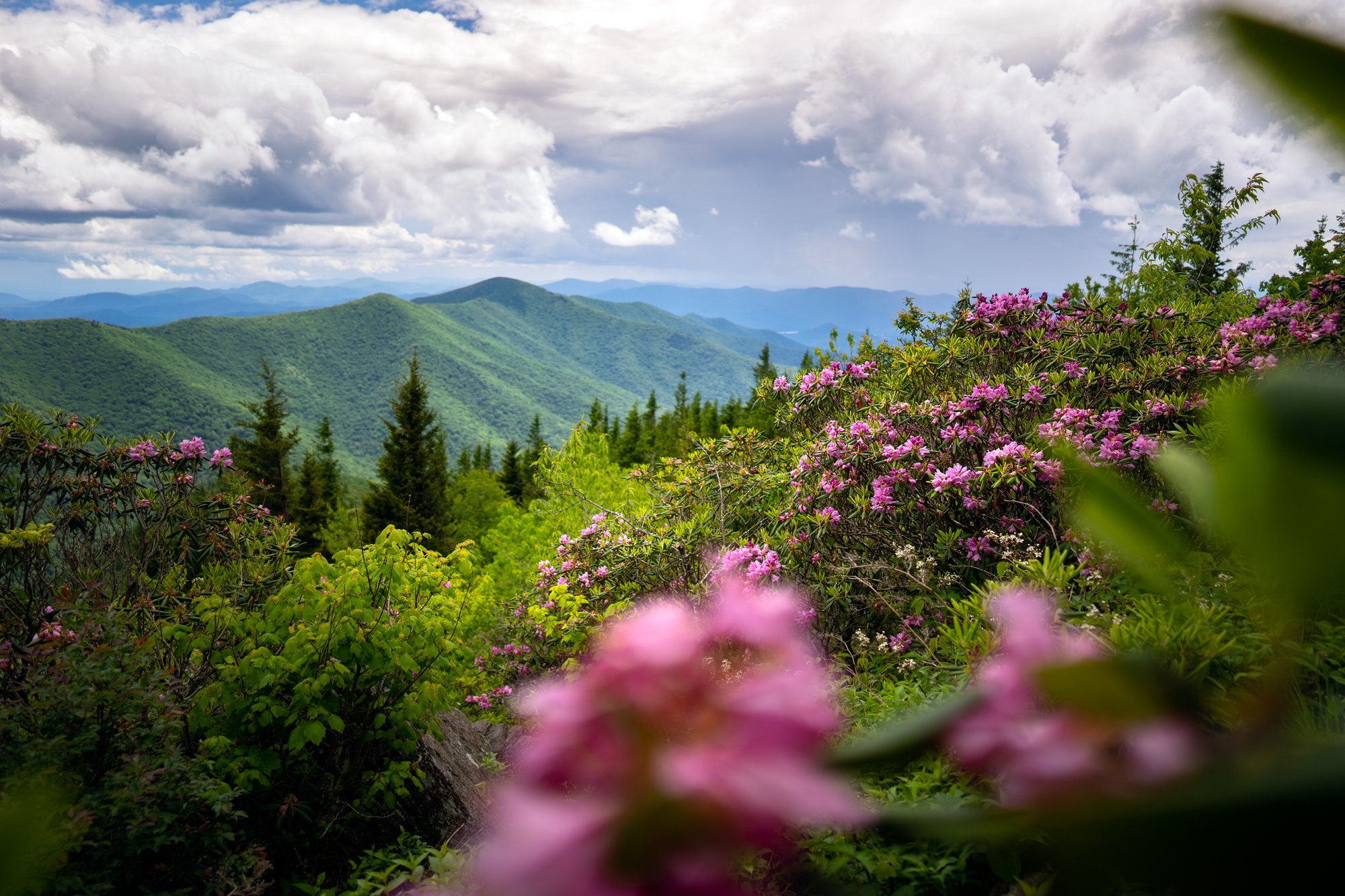
The "Turkey Pen" of the trail's name recalls the livestock pens once used in this part of the Pisgah Ranger District, back when cattle and hogs were driven into these mountains to graze on the open range. Today the loop is better known for the ridge it climbs and the river it follows: rosebay rhododendron blooms along Sharpy Mountain's shoulder through mid-July, and the South Mills River corridor below has long been one of the most popular backcountry camping and mountain biking areas in the district.
Once the trail crests Sharpy Mountain and rolls through Sandy Gap and Wagon Road Gap, it drops steeply through a fern-floored cove forest before finally meeting the river. From there, South Mills River Trail follows an old logging grade—wide, flat, and easy underfoot after everything that came before it—past granite outcrops, tributary streams like Poundingmill Branch, and two wooden suspension bridges that carry hikers back and forth across the water on the way to the final climb out.
What Can I Expect on the Turkey Pen Gap Loop?
From the Turkeypen Road pull-off, the trail climbs almost immediately, ducking through a tight tunnel of mountain laurel before easing onto a hickory-shaded ridge. There's no flat warm-up here—most of the loop's elevation gain comes in this first mile and a half, culminating in a steep, sustained push up and over Sharpy Mountain. Carry all the water you'll need for this stretch; it's dry the whole way.
Past Sharpy Mountain, the trail rolls through a series of smaller gaps—Sandy Gap and Wagon Road Gap among them—with occasional breaks in the trees opening onto the South Mills River valley below. The descent that follows drops steeply through a fern-lined cove, crossing several small streams and stepping over downed trunks before the grade finally relents near the river.
Once you reach the water, the character of the hike changes completely. South Mills River Trail is nearly flat, following an old logging road along the riverbank past granite outcrops and backcountry campsites, and crossing the river twice on wooden suspension bridges. A short, steep, noticeably eroded climb back to Turkeypen Road closes out the loop—enough to work up a sweat even after everything before it.
AllTrails lists this loop at 6.1 miles with 1,259 feet of elevation gain, but several trip reports put the on-the-ground distance closer to 7 miles depending on which junctions you take, so budget extra time and water accordingly.
Extend the Hike Along South Mills River
Hikers with more time can turn this loop into a much longer exploration of the South Mills River trail network, one of the largest in the Pisgah Ranger District. From the river bottom, South Mills River Trail continues well beyond this loop's junctions, connecting to Squirrel Gap, Cantrell Creek, Vineyard Gap, and Bradley Creek trails, which combine into loops of 12 miles or more for hikers and mountain bikers looking for a full day out. The Trace Ridge area, a short drive from Turkeypen Road, offers another popular access point into the same river network for those who'd rather skip the Sharpy Mountain climb.
When Is the Best Time to Hike Turkey Pen Gap?
Spring brings wildflowers and rising creek flow to the cove forest, though snowmelt and heavy rain can make the South Mills River crossings higher and colder than usual.
Summer brings rosebay rhododendron into bloom along the ridge through mid-July, but thick foliage can make the climb feel closed in, and spiderwebs across the trail are common—a stick to clear them ahead of you helps. The first two miles are dry, so carry all the water you need.
Fall cools things down and thins the canopy, reopening the views into the South Mills River valley from the ridge gaps; many hikers consider fall the best season to do this loop.
Winter opens up even more views through the bare hardwoods, though wet-weather sections and river crossings can be icy or running high—check conditions before you go and dress in layers for exposed ridge sections.
AllTrails data suggests this loop can be hiked comfortably in any season, though current storm damage and trailhead access should be checked regardless of the time of year.
How Do I Get There?
The Turkeypen Gap Trailhead is located in the Pisgah Ranger District of Pisgah National Forest, near Horse Shoe in southern Henderson County, roughly 25 miles southwest of downtown Asheville.
From downtown Asheville, take I-26 West to Exit 40 (NC-280/Asheville Regional Airport). Follow NC-280 through Mills River toward Horse Shoe until you reach Turkeypen Road on your left. Turn onto Turkeypen Road (FS-297) and continue about 1.2 miles on gravel to the trailhead parking area at the road's end.
Note: As of this writing, the U.S. Forest Service lists the Turkeypen Gap Trailhead as having limited access due to ongoing storm repairs related to Hurricane Helene. Check the National Forests in North Carolina alerts page before visiting.
Tip: Turkeypen Road is a narrow gravel road with limited parking at the end, and GPS apps can be unreliable on the final turn—search "Turkeypen Road, Horse Shoe, NC 28742" and watch for the small Forest Service sign rather than trusting your app's last-mile routing.
Know Before You Go
- The full Turkey Pen Gap Loop is listed at 6.1 miles round trip with about 1,259 feet of elevation gain—a strenuous half-day hike. AllTrails users often report closer to 7 miles depending on which junctions you take, so budget extra time.
- The first mile and a half is the hardest part of the hike, climbing steeply up and over Sharpy Mountain. Reviewers note that if you make it through that stretch, the rest of the loop is largely downhill or flat.
- Check current U.S. Forest Service trail conditions before visiting—the Turkeypen Gap Trailhead has limited access due to ongoing storm repairs from Hurricane Helene.
- There is no reliable water source for the first two miles of the hike. Carry all the water you'll need for the climb.
- The loop crosses the South Mills River twice on wooden suspension bridges. Some hikers have reported rotted or cracked boards, so cross carefully and one at a time.
- This trail is popular with horseback riders and mountain bikers. Expect to share the trail and watch your footing around manure on the ridge sections.
- Trekking poles are helpful for the steep, eroded sections and the multiple stream crossings along South Mills River Trail.
- Cell service is unreliable to nonexistent in this part of Pisgah National Forest. Download an offline map before you go.
- Parking at the Turkeypen Gap Trailhead is limited to a small gravel lot. Arrive early, especially on weekends.
- Dogs are welcome on leash, but there is no shade or water at the trailhead, so bring extra water for your pet too.
Request a Free Destination Guide
There’s no better way to start your trip planning than with Asheville’s Official Destination Guide.

Sign Up for Our Newsletter
Stay in the know with the best of Asheville delivered straight to your inbox.
Download the Explore Asheville App
Plan your time in Asheville from the comfort of your device.