
Shortoff Mountain Trail

Few summits in the Linville Gorge deliver more view for less mileage than Shortoff Mountain.
Rising above the southern end of Linville Gorge—the rugged canyon often called the "Grand Canyon of the East"—Shortoff Mountain climbs from the shores of Lake James into a windswept, largely open summit plateau shaped by wildfires in 2002 and 2007. The result is a hike that trades dense forest canopy for sweeping, largely unobstructed views nearly the entire way up: south across the blue expanse of Lake James, and north into the sheer cliffs and rugged spine of Linville Gorge itself. It's a strenuous but short introduction to one of western North Carolina's wildest landscapes.
- Length: 4.6 miles, round tripDuration of Hike: 4 hoursElevation Gain: 1,200 feetBlazes: YesFacilities & Parking: A small gravel parking area at the dead end of Wolf Pit Road. No restrooms, water or trash service on site. Parking is permitted only on the National Forest section of the road—the final 200 yards nearest the trailhead.Features: Lakes, Forests, Wildlife, Views, Pet Friendly, Wild Flowers, Open Trail
Shortoff Mountain marks the dramatic southern gatepost of Linville Gorge, where the Linville River finally breaks free of the mountains on its way toward Lake James. Despite a comparatively modest elevation for the region, Shortoff has a reputation among Linville Gorge regulars for commanding some of the most scenic views anywhere in the gorge—the reward of a hike that begins climbing hard and rarely lets up until the summit plateau levels out.
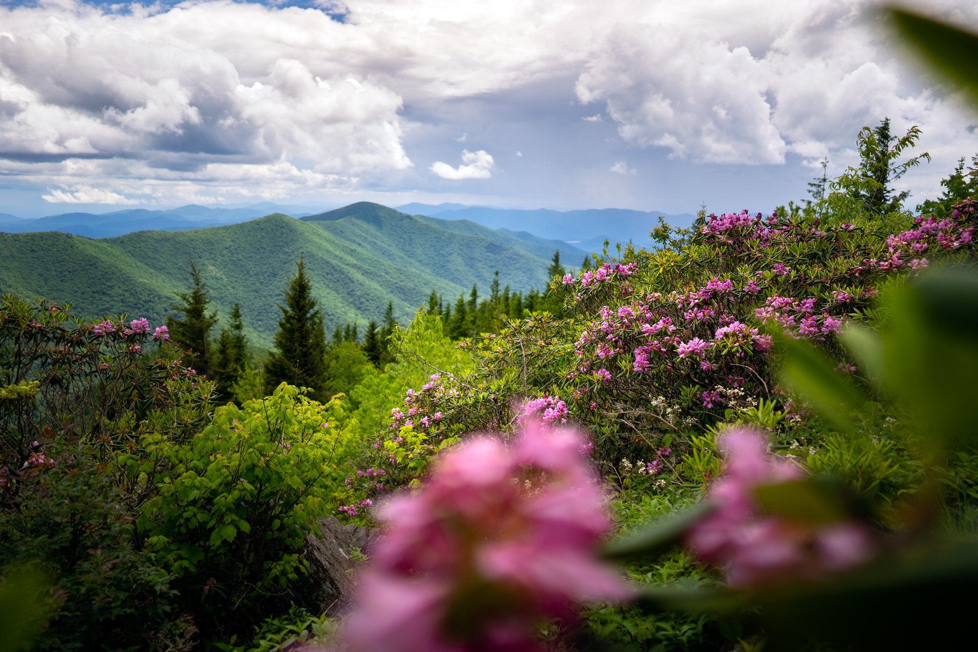
Wildfires burned across the mountain in 2002 and 2007, and much of the route still reflects that history: scorched, sun-bleached snags rise above a recovering understory of pines, hardwood saplings and wildflowers, leaving the trail mostly exposed to sun and wind. That openness is exactly what makes the views so consistently excellent—but it also makes for a hot climb in summer with little natural shade.

What Can I Expect on the Shortoff Mountain Trail?
The hike begins at the small parking turnaround at the end of Wolf Pit Road, an unpaved, semi-private gravel road on the north shore of Lake James. From the trailhead, the unblazed trail heads west and immediately begins a steep, rocky climb up the flank of Shortoff Mountain, gaining roughly 1,100 to 1,300 feet in just the first mile.
Around 0.15 mile, the trail bears right at a hand-painted sign, and by 0.5 mile, the first broad views of Lake James begin to open up through the trees as the trail switchbacks up the slope. The climbing continues in earnest, aided by a set of stone steps around 1.15 miles, before reaching a signed four-way intersection with the Mountains-to-Sea Trail at approximately 1 mile. Continue straight (west) through this junction, following signage toward the Shortoff summit.
By 1.3 miles, the trail crests Shortoff's near-summit, delivering sweeping views south over Lake James and into the southern reaches of Linville Gorge. From here, the grade eases considerably. The trail levels and rolls gently across a broad, largely open summit plateau for the next mile or so, passing rock outcrop after rock outcrop with expanding views north into the gorge and toward Table Rock Mountain and the Chimneys.
Near the top of the plateau, hikers pass a small natural pond—an unusual sight on a North Carolina summit—which marks a good turnaround point and a popular picnic spot with some of the best views of Table Rock in the area. Most day hikers use this area, roughly 2.25 to 2.3 miles from the trailhead, as their destination before retracing their steps back down to Wolf Pit Road for a round trip of about 4.6 miles.
Throughout the hike, keep an eye out for peregrine falcons, which nest on the gorge's cliffs, and watch your footing—the trail is rocky and uneven throughout, and several overlooks sit at unprotected cliff edges with no railings or fencing.
Extend the Hike Toward the Chimneys and Table Rock
Hikers looking for a longer day or a backpacking trip can continue north past the pond, where the trail dips through a shallow saddle around 2.9 miles and climbs back up through rhododendron and galax to Shortoff's true high point near 3.75 miles, with some of the most expansive views of the entire hike from a rugged, near-vertical outcrop.
From there, the trail continues north, descending through Chimney Gap and passing a junction with a connector trail before climbing toward the rock formations known as the Chimneys—a popular rock-climbing destination overlooking the heart of Linville Gorge. Continuing still farther, the same general corridor eventually connects toward Table Rock Mountain, roughly 5 to 6 miles beyond the Shortoff summit, making a rugged multi-day backpacking loop possible for well-prepared hikers with a good topographic map and route-finding skills. Trails in the gorge's interior are unsigned and unblazed once away from the rim, so download an offline map before attempting any extension.
When Is the Best Time to Hike Shortoff Mountain?
Spring brings wildflowers to the burned, open slopes and comfortable temperatures for the exposed climb, though the trail can be muddy and slick after rain.
Summer can be brutally hot on this largely shadeless trail; start early, carry more water than you think you'll need, and wear sunscreen, especially on the first mile of climbing.
Fall offers cooler hiking temperatures and some of the clearest long-range views of the year across Lake James and into the gorge, making it a popular—and sometimes crowded—season on this trail.
Winter strips away what little foliage remains, opening even wider views, though ice on the exposed rock outcrops near the summit can make footing treacherous. The trail is open year-round, but conditions should be checked before a winter visit.
The trail is open and hikeable in every season; the main variable is heat and sun exposure rather than seasonal closures.
How Do I Get There?
Shortoff Mountain is located in the Linville Gorge Wilderness of Pisgah National Forest, near the town of Nebo in Burke County, roughly 45 miles east of downtown Asheville.
From downtown Asheville, take I-40 East to Exit 94, then turn left onto Dysartsville Road and continue 0.7 mile. Turn left onto US 70 West and go 1.7 miles, then turn right onto Bridgewater Road and continue 1.3 miles toward Lake James State Park. Turn left onto Benfields Landing Road and follow it 2.2 miles along the edge of Lake James, then turn right onto NC Highway 126 East and continue 6.6 miles to Wolf Pit Road on the left. Turn left onto unpaved Wolf Pit Road and follow it approximately 2.5 miles to its end, where the trail begins at the parking turnaround.
Allow approximately 1 to 1.25 hours from downtown Asheville, depending on traffic and road conditions.
Note: Wolf Pit Road crosses private property for much of its length before entering National Forest land; please observe posted speed limits (10 mph is typical) and do not stop, park or camp anywhere except the designated National Forest section closest to the trailhead. Hurricane Helene caused extensive damage throughout the Linville Gorge Wilderness, including downed trees, washed-out paths, landslides and altered river crossings; while Shortoff Mountain Trail itself has generally remained accessible, portions of the separate river-level Linville Gorge Trail remain closed, and hazards are widespread throughout the wilderness area. Check current U.S. Forest Service alerts for the Grandfather Ranger District before visiting.
Tip: Trailhead parking is limited and fills quickly on weekends and during peak fall and spring weekends—arrive early. Cell service is unreliable throughout the gorge, and rescue response times can run into hours given the terrain, so let someone know your plans before you go.
Know Before You Go
- This out-and-back hike is approximately 4.6 miles round trip with about 1,200 feet of elevation gain—a hard, front-loaded climb that most hikers complete in 2.5 to 3 hours.
- Trailhead parking is limited to the National Forest section of Wolf Pit Road, roughly 200 yards from the trailhead. Vehicles parked on the private section of the road will be towed.
- Much of the trail crosses open, fire-recovered terrain with little shade—bring more water than usual and sun protection, especially in summer.
- The trail is unblazed for its first mile, joining the white-blazed Mountains-to-Sea Trail near the 1-mile mark; download an offline map, as intersections can be tricky to navigate.
- Several overlooks and outcrops sit at unprotected cliff edges with no railings—use caution, especially with children and pets.
- Hurricane Helene caused significant, ongoing damage throughout Linville Gorge Wilderness. Check current U.S. Forest Service conditions before visiting, and expect downed trees, erosion and altered stream crossings even on open trails.
- Dogs are welcome but should be kept on a leash, particularly near cliff-edge viewpoints.
- Backcountry camping is available along the route; permits are required on weekends and holidays from May 1 through October 31, and group sizes are capped at 10 people.
- There is no cell service through most of the gorge, and rescue response times can be long given the remote, rugged terrain—hike with a partner and carry a map, extra water and a first-aid kit.
- No facilities (restrooms, water, trash service) exist at the trailhead; the nearest are at Lake James State Park.
Request a Free Destination Guide
There’s no better way to start your trip planning than with Asheville’s Official Destination Guide.

Sign Up for Our Newsletter
Stay in the know with the best of Asheville delivered straight to your inbox.
Download the Explore Asheville App
Plan your time in Asheville from the comfort of your device.