
Linville Gorge Loop

Locally, this route has earned an unofficial nickname: the "Is That All You Got?!" loop—and it's not an exaggeration.
This roughly 22-mile loop stitches together some of the best-known trails and landmarks in the Linville Gorge Wilderness—Shortoff Mountain, the Chimneys, Table Rock, and the Linville River itself—into a single, punishing circuit around the "Grand Canyon of the East."
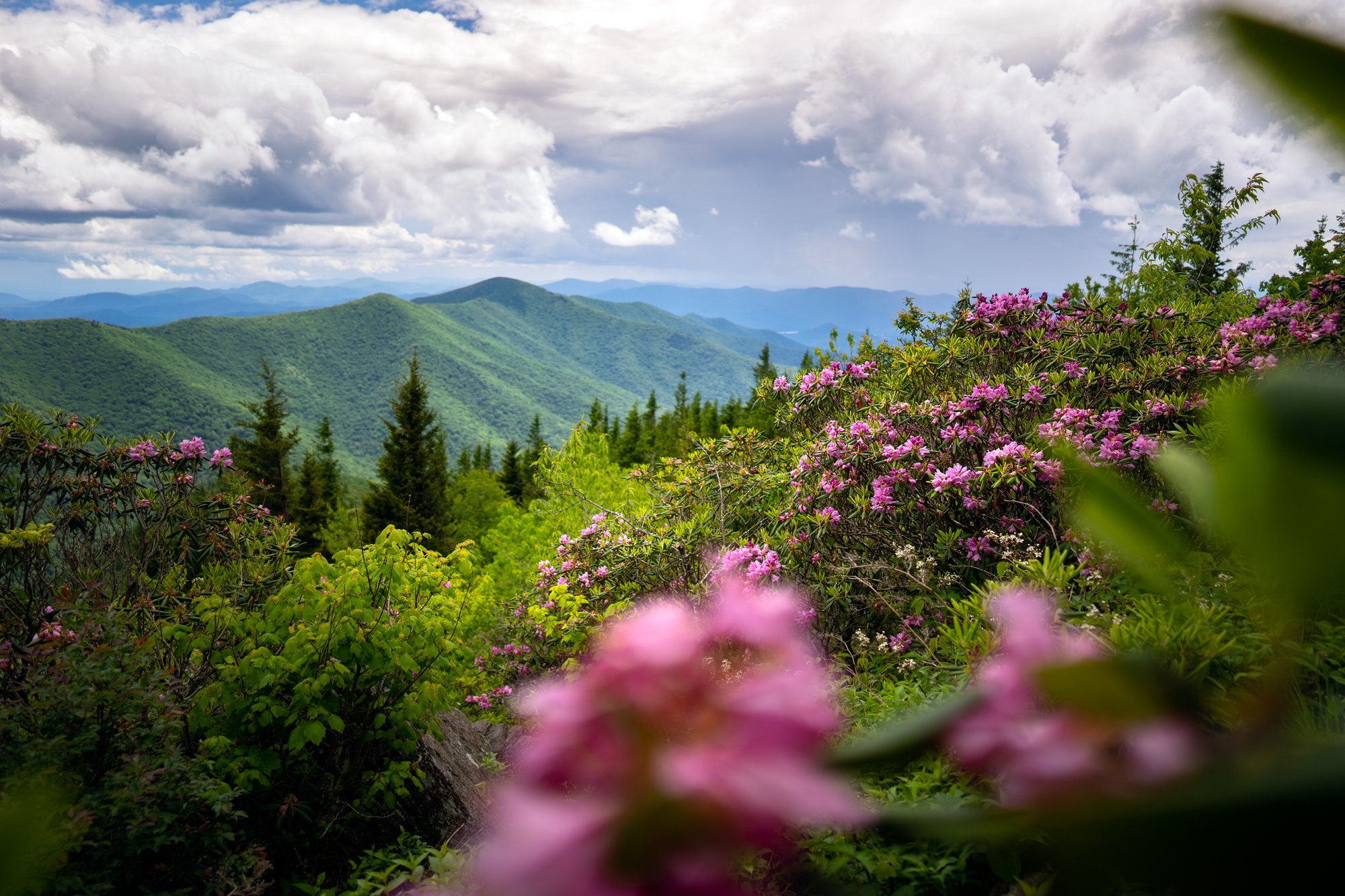
- Length: 22.3 miles round tripDuration of Hike: 11-12 hoursElevation Gain: 5,134 feetBlazes: YesFacilities & Parking: Unattended gravel parking at the end of Wolf Pit Road. No restrooms, water or trash service. An alternate start/end point is available at the Table Rock parking area.Features: Forests, Wildlife, Views, Rivers, Pet Friendly, Wild Flowers, Open Trail
Linville Gorge is one of only two wilderness gorge areas in the eastern United States, and this loop crosses nearly all of it: the fire-scarred, view-heavy ridge above Shortoff Mountain and the Chimneys, the dramatic rock outcrops near Table Rock, and the shaded, boulder-strewn Linville River corridor at the bottom of the canyon. Locals warn that "every mile in the gorge feels like two"—expect steep, switchback-free climbs and descents, rough footing, and route-finding challenges that make this a considerably harder undertaking than its mileage alone would suggest.

What Can I Expect on the Linville Gorge Loop?
Most hikers begin at the Wolf Pit Road trailhead, climbing roughly 800 feet in the first mile up the same steep, unblazed grade used by the standalone Shortoff Mountain Trail. After joining the Mountains-to-Sea Trail near the top, the route follows the gorge's eastern rim north, passing Shortoff Mountain's open summit plateau, its burn-scarred heath balds, and sweeping views down into the canyon and south toward Lake James.
Continuing north, the trail descends through Chimney Gap and climbs to the Chimneys, a dramatic cluster of rock spires and a popular rock-climbing destination with some of the best views in the gorge. From there, the route continues along the ridge toward Table Rock Mountain, one of the most recognizable landmarks in the gorge, before dropping steeply—without switchbacks—toward the Linville River.
River crossings are a defining feature of this loop and among its most serious hazards. Common crossing points include Spence Ridge and Devil's Hole; neither has a bridge (the Spence Ridge Trail bridge over the Linville River is currently washed out), and water levels vary dramatically with rainfall, from an easy ankle-deep wade to a genuinely dangerous ford. Many hikers plan their trip around low-water conditions and are prepared to turn back if a crossing looks unsafe.
Once across the river, the route picks up the Linville Gorge Trail (also called the Linville River Trail or Leadmine Trail), following the river south through shaded, rocky terrain past popular backcountry campsites, swimming holes, and side-trail junctions with Conley Cove, Pinch In, and Daffodil Flats. Private property in the middle of this river corridor creates a dead end on the direct route; most hikers instead climb out via the Pinch-In Trail to a ridgetop road, pick up the Pinnacle Rock Trail, and descend back to reconnect with the Mountains-to-Sea Trail near the river for a second, equally demanding crossing.
From that second crossing, the final stretch climbs roughly 1,800 feet with no switchbacks back to the ridge, rejoining the trail junction that leads back down to the Wolf Pit Road parking area to close the loop.
Route Variations and Alternate Starting Points
Because the gorge's interior trails are largely unofficial, unsigned, and shaped by hiker use over time, few groups hike the exact same route twice. Some parties start and end at the Table Rock parking area instead of Wolf Pit Road. Others choose Devil's Hole over Spence Ridge for one of the two river crossings, trading a more difficult ford for the chance to pass by Hawksbill Mountain along the way. Trip reports commonly describe the full circuit as anywhere from 22 to 35 miles depending on these choices, and the terrain-adjusted difficulty rating (based on grade and footing, not just distance) is considerably harder than the mileage suggests.
Given this variability, a detailed topographic map—many hikers recommend the Avenza app with the Linville Gorge wilderness map, which distinguishes official trails from unofficial "social" trails—is essential. General-purpose maps, including standard National Geographic trail maps of the area, are not considered sufficient for safe navigation of the gorge's interior.
When Is the Best Time to Hike the Linville Gorge Loop?
Spring brings comfortable temperatures and full river flow, meaning easier access to water but potentially more difficult, higher-volume crossings after rain.
Summer is hot and humid along the river corridor and hot, exposed and dry along the eastern ridge; water sources can be scarce on long ridge stretches, so plan refill points carefully and carry more capacity than usual.
Fall offers cooler hiking temperatures, lower water levels for river crossings, and some of the clearest long-range views of the year—making it the most popular, and most crowded, season for this loop. Camping permits are required on weekends and holidays from May 1 through October 31.
Winter can bring snow and ice to the higher, exposed sections of the ridge—trip reports describe 15 to 20 miles of snow and ice in the gorge's northern reaches, along with wind gusts of 60 to 70 mph atop Table Rock and the Chimneys. Only experienced, well-equipped winter backpackers should attempt this route in these conditions.
How Do I Get There?
The Wolf Pit Road trailhead is located in the Linville Gorge Wilderness of Pisgah National Forest, near the town of Nebo in Burke County, roughly 45 miles east of downtown Asheville.
From downtown Asheville, take I-40 East to Exit 100, then head north onto Jamestown Road (NC-1142), which becomes Independence Boulevard. Turn left onto NC Highway 126 West and continue approximately 11.2 miles, then turn right onto unpaved Wolf Pit Road. Follow Wolf Pit Road approximately 2.4 miles to its dead end, where unattended gravel parking is available at the trailhead.
Allow approximately 1 to 1.25 hours from downtown Asheville, depending on traffic and road conditions.
Note: Portions of the Linville Gorge Trail directly on this loop's standard route remain closed due to Hurricane Helene damage, including the sections between Daffodil Flats and Pitch-In, Spence Ridge and Conley Cove, and Cabin and Bynum Bluff. The Spence Ridge Trail bridge over the Linville River is also currently washed out, requiring a wet crossing. Given how central these segments are to completing the loop as described, check current U.S. Forest Service alerts for the Grandfather Ranger District and the G5 Trail Collective's Helene recovery map before attempting this route, and be prepared to adjust your plan or turn back.
Tip: Wolf Pit Road crosses private property before reaching National Forest land; observe posted speed limits and only park in designated areas. Trailhead parking is unattended and fills quickly on fall weekends.
Know Before You Go
- This is a rugged, roughly 22-mile loop (often closer to 25–30+ miles depending on route choice) with about 5,134 feet of elevation gain—typically planned as a 2- to 3-day backpacking trip rather than a day hike.
- Portions of the standard route are currently closed due to Hurricane Helene damage, and the Spence Ridge bridge over the Linville River remains washed out. Check current conditions before you go, and have a backup plan.
- River crossings have no bridges at most points and can range from an easy wade to a dangerous ford depending on recent rainfall; be prepared to turn back if a crossing looks unsafe.
- Trails inside the wilderness are signed only at trailheads—not blazed or signed once inside the interior. A detailed topographic map (such as the Avenza Linville Gorge map) is essential; general road atlases and basic trail maps are not sufficient.
- Camping permits are required on weekends and holidays from May 1 through October 31 through the Grandfather Ranger District; group sizes are limited to 10 people.
- Water sources are limited on the eastern ridge sections (Shortoff, the Chimneys, Table Rock); plan refill points carefully and carry more capacity than a typical hike.
- Cell service is unreliable to nonexistent throughout the gorge, and rescue response times in the interior can run from several hours to over 24 hours. Hike with a partner and leave a detailed itinerary with someone outside the group.
- Dogs are welcome but must be kept on a leash.
- The terrain includes steep, switchback-free climbs and descents, loose rock, and stream crossings; footwear and gear suited to wet, technical terrain are strongly recommended.
- No facilities exist at either the Wolf Pit Road or Table Rock trailheads. Fill up on water and supplies before you arrive.
Request a Free Destination Guide
There’s no better way to start your trip planning than with Asheville’s Official Destination Guide.

Sign Up for Our Newsletter
Stay in the know with the best of Asheville delivered straight to your inbox.
Download the Explore Asheville App
Plan your time in Asheville from the comfort of your device.