
Hawksbill Mountain Trail

Some mountain views unfold slowly. Hawksbill Mountain arrives like a revelation.
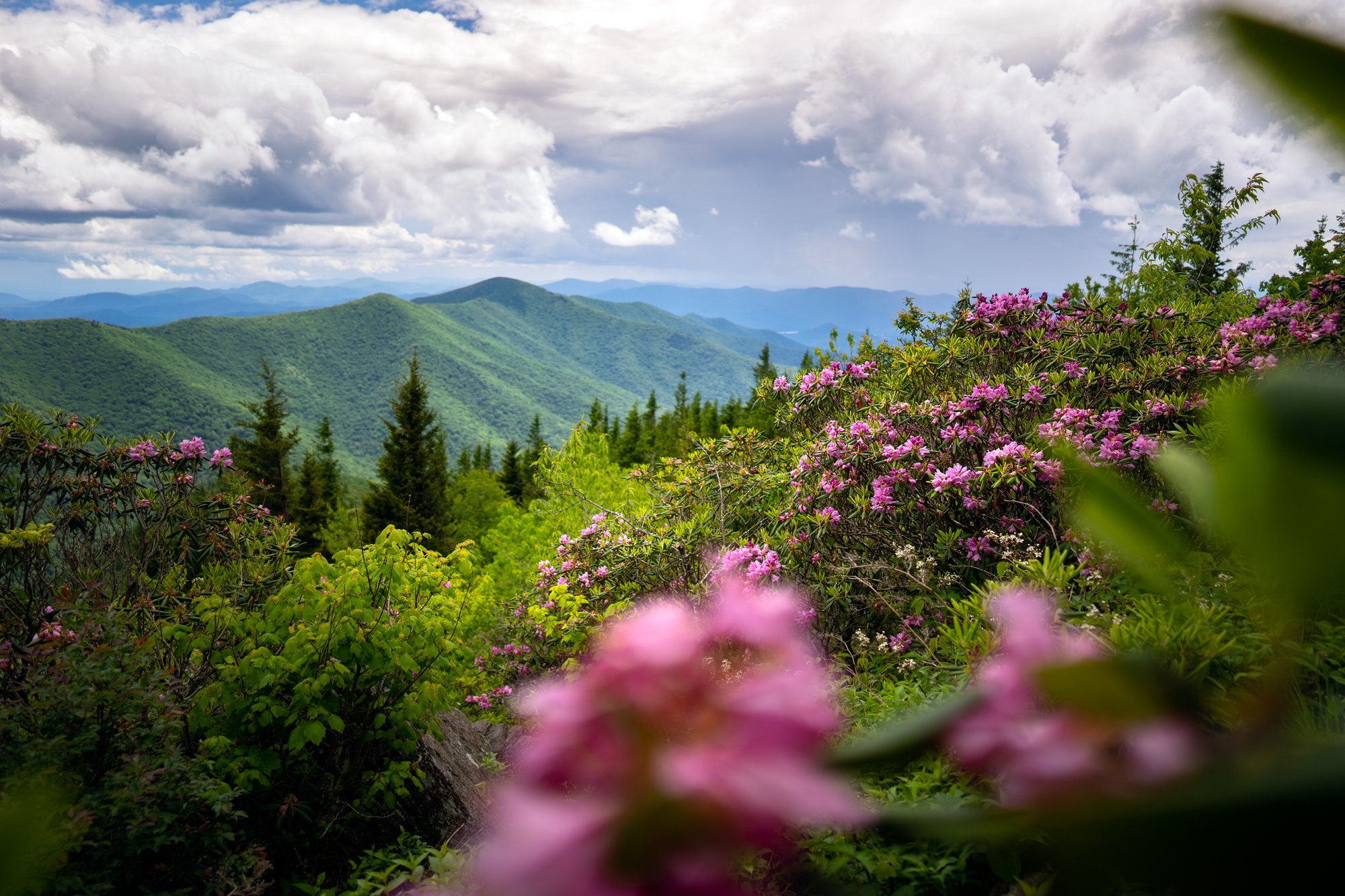
The trail climbs through a quiet hardwood forest, weaving past moss-covered stone, tangled rhododendron and pockets of mountain laurel before the trees begin to thin. Then, almost without warning, the landscape opens.
- Length: 2.2 miles round tripDuration of Hike: 1.5-2.5 hoursElevation Gain: 700 feetBlazes: YesFacilities & Parking: Small gravel parking area along an unpaved Pisgah National Forest road. No restrooms, water or other facilities at the trailhead.Features: Forests, Wildlife, Views, Kid Friendly, Pet Friendly, Wild Flowers, Open Trail
Rising to approximately 4,009 feet along the eastern rim of Linville Gorge, Hawksbill Mountain earns its name from the sharp, projecting rock formations near its summit. The mountain overlooks a gorge that falls roughly 2,000 feet toward the Linville River, creating unusually dramatic views for a hike of this length.
Hawksbill sits north of Table Rock Mountain within the Linville Gorge Wilderness, a rugged landscape of steep walls, exposed cliffs and densely forested ridges. Unlike trails that descend toward the gorge floor, this route climbs toward the rim, rewarding hikers with wide views across Pisgah National Forest.
Hawksbill Mountain trail climbs through hardwood forest and tangled rhododendron before emerging onto the mountain’s angular summit, where Linville Gorge drops sharply below and ridgelines stretch toward every horizon. Table Rock rises to the south, the Linville River winds nearly 2,000 feet below and, on an especially clear day, the Charlotte skyline may appear in the distance.
The hike is relatively short, but the final climb is steep, rocky and demanding. Give yourself time, bring more water than the mileage might suggest and save a while for the top. Hawksbill’s summit offers several rocky overlooks, each revealing a different side of one of Western North Carolina’s wildest landscapes.
What Can I Expect on Hawksbill Mountain?
The hike begins across the road from the gravel parking area and enters a young hardwood forest scattered with pine. The first stretch is relatively gradual, winding around the mountainside through switchbacks, moss-covered rocks and dense stands of rhododendron and mountain laurel.
At around 0.3 miles, the trail passes a shallow rock overhang before continuing uphill. The terrain grows rockier as the route gains elevation, and occasional openings through the trees offer an early glimpse of the surrounding mountains.
Near the 0.7-mile mark, the trail reaches a signed junction close to the Jonas Ridge Trail. Turn left toward the Hawksbill summit. The climb becomes noticeably steeper here, with rocky footing and a series of short switchbacks leading toward the ridgeline.
Just below the summit, the path divides. The route to the right is longer and more gradual, while the more direct path continues into a shorter, steeper climb. Both reach the summit area.
At the top, the trail opens near a large backcountry campsite and divides again between two principal viewpoints. Head left for a clearer look toward Table Rock and Shortoff Mountain. Turn right for Hawksbill’s broadest summit views, where exposed rock overlooks the length of Linville Gorge and the surrounding Pisgah National Forest.
The northern summit provides the most expansive panorama. Table Rock’s distinctive profile rises to the south, with Shortoff Mountain and Lake James beyond it. To the west, the Linville River cuts through the bottom of the gorge, nearly 2,000 feet below the summit. On exceptionally clear days, Burke County Tourism notes that hikers may even see the Charlotte skyline.

When Is the Best Time to Hike Hawksbill Mountain?
Hawksbill Mountain offers something different in every season, although access along the unpaved forest road may change with weather and road conditions.
Spring brings fresh green growth, mountain laurel and rhododendron to the forested slopes. Rain and lingering moisture can make the rocky upper trail slick, so sturdy footwear is especially important.
Summer fills the gorge with deep green and usually brings cooler conditions at the summit than in the valleys below. The exposed rock can still become hot in direct sun, and afternoon thunderstorms can develop quickly. Start early and avoid the summit when thunder is nearby.
Fall transforms the gorge into layers of red, orange and gold. It is also one of the busiest times to visit, and the small roadside parking area may fill early. Plan a weekday visit or arrive early in the morning.
Winter can offer the clearest long-distance views, but snow, ice and freeze-thaw conditions may make both the trail and gravel access road hazardous. The Forest Service may temporarily close roads because of weather, storm damage or maintenance, so check current alerts before departing.
Sunrise can be especially striking from the exposed summit, but reaching it in the dark requires careful preparation. Bring a headlamp, download an offline map and leave enough time to navigate the rocky upper trail before daylight.
How Do I Get There?
From downtown Asheville, take I-40 East toward Marion. Use Exit 72 for US-70 toward Old Fort, then continue east to US-221 North. Follow US-221 toward Linville Falls and turn right onto NC-183. Continue to NC-181, turn right and travel south for approximately three miles.
Turn right onto Gingercake Road, also identified along portions of the route as Forest Service Road 210. At the first fork, bear left and continue through the Gingercake Acres community. The road becomes unpaved as it enters Pisgah National Forest. Continue toward the signed Hawksbill Mountain parking area, which will be on the left, with the trail beginning across the road.
Know Before You Go
- The trail is short, but the roughly 700 feet of climbing and steep final approach make it more demanding than the mileage suggests.
- Parking is limited to a small gravel pull-off. Do not block the forest road or park on vegetation.
- There are no restrooms, drinking water stations or trash cans at the trailhead.
- The final drive is on a narrow, unpaved forest road. Conditions can deteriorate after heavy rain, snow or storms.
- Cell service is limited or unavailable. Download maps and directions before leaving Asheville.
- The summit has exposed cliffs and no railings. Stay well back from the edge and closely supervise children and pets.
- Dogs are allowed but should remain leashed and under control.
- Avoid the summit during thunderstorms. Exposed rock is not a safe place to wait out lightning.
- Backcountry camping is permitted in parts of Linville Gorge, but separate regulations and seasonal permit requirements may apply.
- Check current National Forest alerts and road conditions before making the drive.
Request a Free Destination Guide
There’s no better way to start your trip planning than with Asheville’s Official Destination Guide.

Sign Up for Our Newsletter
Stay in the know with the best of Asheville delivered straight to your inbox.
Download the Explore Asheville App
Plan your time in Asheville from the comfort of your device.