
Black Mountain Crest Trail Hike to Mount Mitchell

Some mountains hand you a view. These make you earn it.
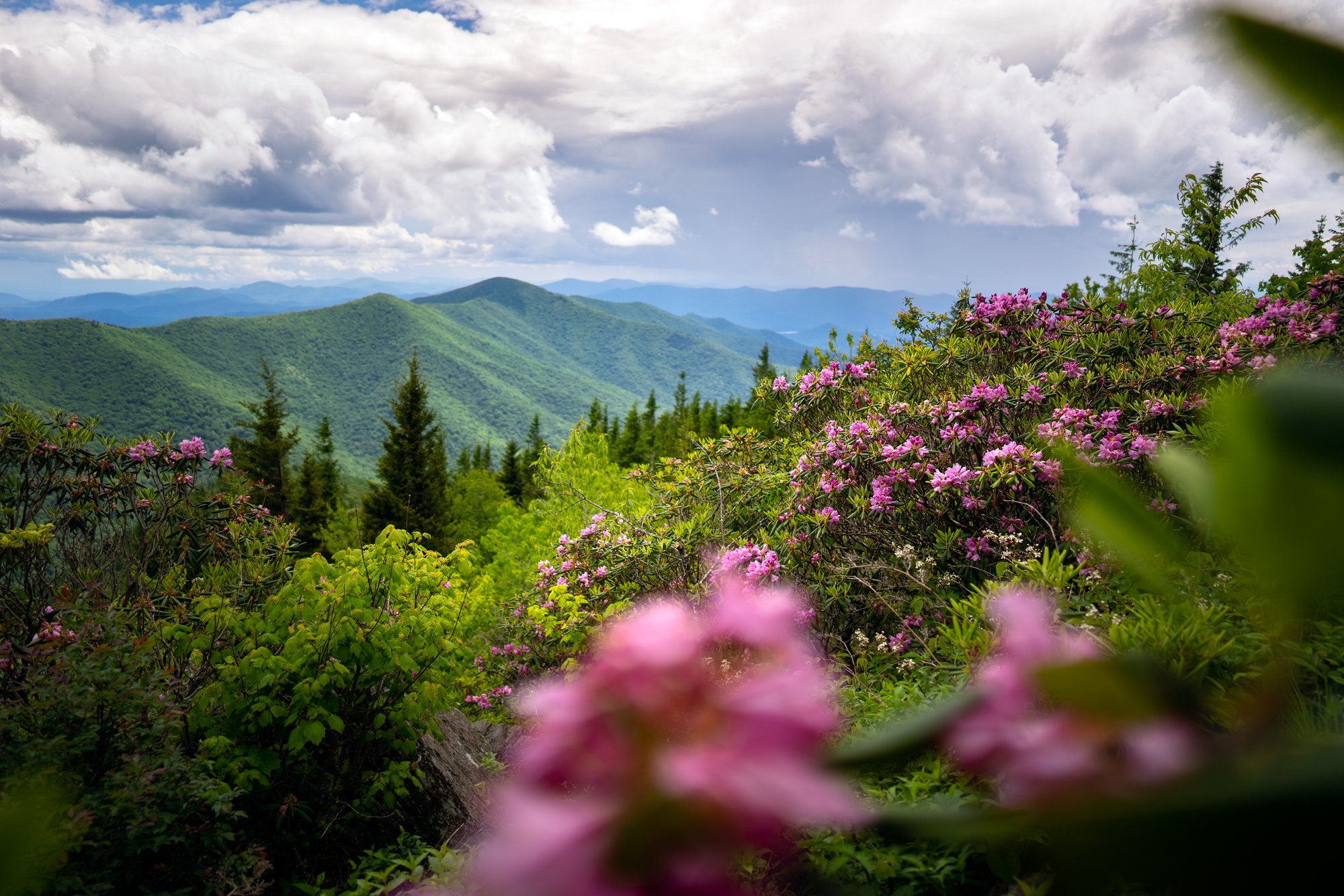
The Black Mountain Crest Trail runs the spine of the highest ridge in the eastern United States, crossing or skirting ten peaks above 6,000 feet in a little over eleven miles. Spruce and Fraser fir close overhead. Rope-assisted scrambles drop you into gaps and haul you back out. Then the trees fall away in the meadow below Celo Knob and the whole Land of the Sky opens up.
- Length: 11.2 miDuration of Hike: 9 to 11 hours one wayElevation Gain: About 1,650 feet of climbing and 5,100 feet of descent hiking north from the summit. Reverse the direction and those numbers flip.Blazes: YesFacilities & Parking: Large paved lot, restrooms, water, picnic area and museum at the Mount Mitchell summit end. The Bowlens Creek end has a small unmarked pull-off on Watershed Road with room for three to five small vehicles small vehicles and no facilities.Features: Forests, Views, Open Trail
Locals talk about this ridge the way they talk about family: with respect, and a story about the day it humbled them. Adrenaline and stillness get along just fine up here. You will meet both, usually within the same mile.
You do not have to hike all of it to feel it. Two miles round trip from the Mount Mitchell summit lot gets you to Mount Craig, the second highest peak in the East. The rest of the ridge waits for the day you are ready.
For current conditions and recent trip reports, check the AllTrails page before you go.
What can I expect on the Black Mountain Crest Trail?
The trail starts at the picnic area below the Mount Mitchell summit parking lot, where it is signed as the Deep Gap Trail. Same footpath, two names. Walk through the picnic area, past the restored log cabin, and the gravel gives way to root and rock.
About a mile in you reach Mount Craig at 6,647 feet, the second highest peak in the East and 37 feet shy of Mitchell. Most visitors turn around here, and that is a fine day. Read our Deep Gap Trail guide if that is the hike you want.
Keep going and the trail changes character fast. Big Tom (6,581 feet) comes next, named for Tom Wilson, the bear hunter and tracker who found Dr. Elisha Mitchell's body in 1857. The north face of Big Tom is the steepest ground on the route, and fixed ropes are there because they are needed. Below it, the Big Tom Gap Trail branches east toward the Buncombe Horse Range Trail.
From there the ridge rolls. The trail crosses Balsam Cone (6,611 feet), then skirts Cattail Peak (6,580 feet), whose true summit sits a fifth of a mile off the tread. Potato Hill (6,475 feet) comes next, then wooded Deer Mountain (6,110 feet), then the long drop into Deep Gap at 5,740 feet, 3.5 miles from Mitchell. Deep Gap holds a primitive camp area and is the only legal campsite inside the state park.
North of Deep Gap the trail leaves the state park and enters Pisgah National Forest, where the N.C. High Peaks Trail Association keeps it open. Winter Star Mountain (6,212 feet) climbs first, with a benchmark and a good campsite just off the trail. Gibbs Mountain (6,224 feet) follows, then Percy's Peak (6,331 feet). Ask anyone who has done the whole thing and they will tell you the stretch between Winter Star and Gibbs is where the trail collects its reputation.
Celo Knob (6,327 feet) sits 6.7 miles from Mitchell, and the trail passes below it rather than over it. Skip the steep side path to the wooded summit. The meadow just below opens into long views on both sides of the range, and that is the real payoff. From here the trail drops roughly 3,500 feet down the head of Bowlens Creek, following an old logging road past mine workings from the early 1900s, then into mature hardwood and creekside fishing pools before reaching Bolens Creek Road.

Which direction should I hike, and where do I park?
Starting at the summit means the net elevation runs downhill, which sounds easier than it hikes. The climbs out of each gap add up, and the final descent to Bowlens Creek is hard on knees.
Point to point (11.2 miles, 9 to 11 hours). Leave one vehicle at the Bowlens Creek end and drive the other to the Mount Mitchell summit lot. The shuttle drive between trailheads runs 45 minutes to an hour by way of NC 80 and the Blue Ridge Parkway. Some hikers hire a local shuttle instead.
Mount Craig out and back (2.1 miles, 1 to 1.5 hours). Park at the summit lot. Best option for a first look at the ridge.
Celo Knob out and back (9 miles, 6 to 7 hours, more than 3,000 feet of gain). Start at Bowlens Creek. Four miles of steady, unrelenting climb with no technical scrambling, ending in the meadow views below Celo Knob. This is the route the N.C. High Peaks Trail Association leads on guided hikes.
Parking at Bowlens Creek deserves a warning. The lot is a small unmarked pull-off on Watershed Road, a private drive off Bolens Creek Road (SR 1109), with room for a handful of small vehicles and nothing bigger. It sits among private homes. Do not park at the family cemetery nearby. Signs prohibit it, and several online sources still send hikers there by mistake. The road past the Pisgah National Forest sign is not driveable. Do not block the Forest Service gate.
Overnight parking at the Mount Mitchell summit lot requires free registration with a park ranger. The park gate also closes at posted hours, so a full traverse has to start early.

How do I get to the Black Mountain Crest Trail from Asheville?
About 35 miles by Parkway to the summit, or 35 miles by highway to Bowlens Creek
To the Mount Mitchell trailhead (summit end): From downtown Asheville, take I-240 east to Exit 7 for US 70 east, then follow signs for the Blue Ridge Parkway and turn north at Milepost 382.5. Stay on the Parkway 27 miles to Milepost 355.3 and turn left onto NC 128 at the signed park entrance. Drive 4.5 miles to the summit parking area. Allow 75 to 90 minutes.
To the Bowlens Creek trailhead (north end): Take I-26 west from Asheville toward Mars Hill, then Exit 9 onto US 19 east and follow it about 16 miles to Burnsville. From Burnsville, go east on US 19E for a half mile and turn right onto NC 197 south. Turn left onto Bolens Creek Road (SR 1109) and follow it to the sharp hairpin turn, where Watershed Road leaves to the left. Allow about 45 minutes.
Two things to plan around. Parkway repairs from Hurricane Helene continue between Milepost 382.5 and the park entrance, with a 35 mph limit, heavy truck traffic and intermittent one-lane control. The Parkway north of the park stays closed, so this is the only approach. And there are no gas stations between Asheville and the summit. Fuel up for a 70-mile round trip before you leave the city.
When is the best time to hike to avoid crowds?
Be at the park gate when it opens at 7 a.m. The summit lot fills by mid-morning on warm weekends, and a 10-hour traverse needs that early start anyway. Summer afternoons push thunderstorms across exposed ground, which gives you one more reason to move at dawn.
Aim for Tuesday through Thursday if your schedule allows it. The Mitchell-to-Mount Craig stretch carries heavy weekend traffic in any warm month, and that first mile is where nearly everyone goes.
Late April through May brings spring wildflowers, cool air and thin crowds, and the first two weeks of November run quiet and clear. October is the busiest stretch on the calendar, when Parkway leaf-season traffic backs up long before you reach the trailhead. Winter access stays unreliable because the Parkway closes for ice, and when it does, the summit trailhead becomes unreachable.
Here is the reliable trick: crowds thin sharply past Big Tom Gap, about 1.4 miles in. North of Deep Gap you can hike all day and pass one other group.
Know Before You Go
- Mount Mitchell State Park is free and open every day but Christmas, with seasonal gate hours that run as early as 7 a.m. to 6 p.m. in winter and 7 a.m. to 10 p.m. in summer. Restaurant, concession and gift shop hours change through the season, so check the park website before counting on food at the summit.
- Budget the whole day. Nine to eleven hours one way is normal, and experienced hikers routinely move slower here than they expect. Carry a headlamp even on a summer traverse.
- Carry all your water. There is no reliable water on the ridge. Springs sit well below Deep Gap, down a steep side path. Plan on three to four liters and treat anything you collect.
- Respect the scrambles. The north face of Big Tom and sections between Winter Star and Gibbs use fixed ropes and hands-on climbing. Wet rock and roots are the real hazard. Trekking poles and grippy soles both earn their weight.
- Dress for 15 to 20 degrees cooler than Asheville. Wind is near constant, cloud cover is common, and rime ice forms on the ridge well into spring. Pack a wind shell, hat and gloves even in July.
- Watch the sky. Get off the high, exposed ground before early afternoon in summer storm season.
- Assume no cell service. Download offline maps, carry a paper map of the South Toe River, Mount Mitchell and Big Ivy area, and leave your route and turnaround time with someone at home.
- Check trail status first. Helene-related landslides, blowdowns and washouts still exist on connecting trails in the area. Confirm with Mount Mitchell State Park before you commit.
- Keep dogs leashed. Pets are welcome and required to be on a leash of six feet or less.
- Be a good neighbor at Bowlens Creek. The trailhead sits beside private homes and a family cemetery. Park only in the designated pull-off, skip the cemetery entirely, and keep the pre-dawn noise down.
Make it your nature to Leave No Trace.
Request a Free Destination Guide
There’s no better way to start your trip planning than with Asheville’s Official Destination Guide.
Sign Up for Our Newsletter
Stay in the know with the best of Asheville delivered straight to your inbox.
Download the Explore Asheville App
Plan your time in Asheville from the comfort of your device.