Sam Knob at Black Balsam Trail
By Joanne O'Sullivan
Sam Knob at Black Balsam Trail Details
Difficulty: Moderate
Length: 2.5 miles
Region: Blue Ridge Parkway
Duration of hike: 1 hour each way to the summit and back
Elevation gain: 570 feet
Type: Out & Back
Blazes: Blue
Facilities & Parking: Parking lot; compost toilet
Features: Pet Friendly, Views
Directions to Trail Head | Open in Google maps
Hike to views that will make your heart sing
An alternative to the popular Black Balsam Knob hike that can be accessed from the same parking lot off the Blue Ridge Parkway, Sam Knob will win your heart with high mountain meadows and long-range wilderness views that rival any in the region.

LEAVE NO TRACE TIP
Sam Knob Trail follows an old roadbed that is prone to erosion. In fact, stairs and a boardwalk were installed to help hikers traverse the washed out areas. Stick to the designated trail to prevent further erosion.
What To Expect
When you arrive in the Black Balsam parking lot, you’ll see a sign for Sam Knob to the right of the pit toilet and left of the information board. The trail goes through sparse forest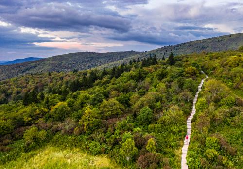 before opening onto a meadow. Starting down the wooden boardwalk steps into the open meadow that leads to the knob, you might just be moved to a Julie Andrews moment of spontaneous song. The scenery is nearly alpine and alive with wildflowers in the spring and summer, tinted with gentle color in the fall. Sam Knob is straight ahead.
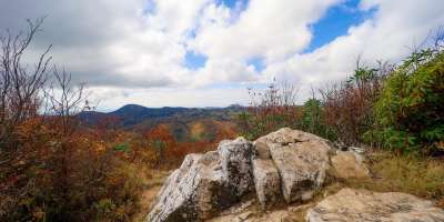
After you cross the meadow, the trail splits, with the left side heading down the Flat Laurel Creek (a great, add-on trail that lets you loop back to the parking lot for a total of 5.3 miles). To reach the summit of Sam Knob, take the Sam Knob Trail to the right, which takes you .6 mile up with a few switchbacks at the start. The trail is mostly wooded, with a few wooden steps in particularly steep areas. There are several rocky overlooks along the way. At the top, you’ll get ultimate serenity and views of Middle Prong and Shining Rock Wilderness. There are several flat rocks for picnicking. While Sam Knob doesn’t have the highest concentration of blueberries in the area, you’ll find bushes here that ripen around mid-August.
When you come back down to the intersection of the two trails, you can go back to the parking lot or make a loop by going left to the Flat Laurel Creek trail. Camping is allowed anywhere except within 500 feet of the road or in closed areas.
Top Photo credit: @brookandholler
Directions
From downtown, take I-240 West to I-26 East. Take Exit 33 (marked Blue Ridge Parkway-Brevard Road-Hwy 191). Turn left (south) onto Highway 191 and go 2.1 miles, passing brown signs for Blue Ridge Parkway and NC Arboretum. Turn right at the entrance to The North Carolina Arboretum and follow signs for the Blue Ridge Parkway. Turn south on the parkway and drive to Milepost 420, Black Balsam. Turn right onto Black Balsam Road and go 2 miles to the parking lot.
GPS Coordinates
N35.325617, W82.881987
We all love the Blue Ridge Mountains! By working together, we can keep these incredible outdoor spaces beautiful and pristine for years to come. Make it your nature to Leave No Trace: Leave what you find, pack out what you pack in, stay on designated trails and plan ahead. To learn more about the 7 Principles of Leave No Trace, CLICK HERE >>.